"I
pledge
allegiance
to
the
flag
of
the
state
of
Louisiana
and
to
the
motto
for
which
it
stands:
A
state,
under
God,
united
in
purpose
and
ideals,
confident
that
justice
shall
prevail
for
all
of
those
abiding
here."
Federal government land was divided for allocation purposes
into 6 mile (480 chains) squares formed by Townships running north/south and
Ranges running east/west from principal meridians. Each square was
evenly divided into thirty-six 1/6 sq. mi. (640ac.) sections beginning with
#1 in the northeast corner and proceeding sequentially east to west to #6,
then due south to #7 proceeding west to east to #12, then due south to #13,
and so forth. (If that doesn't make sense see the BLM General Land
Office's
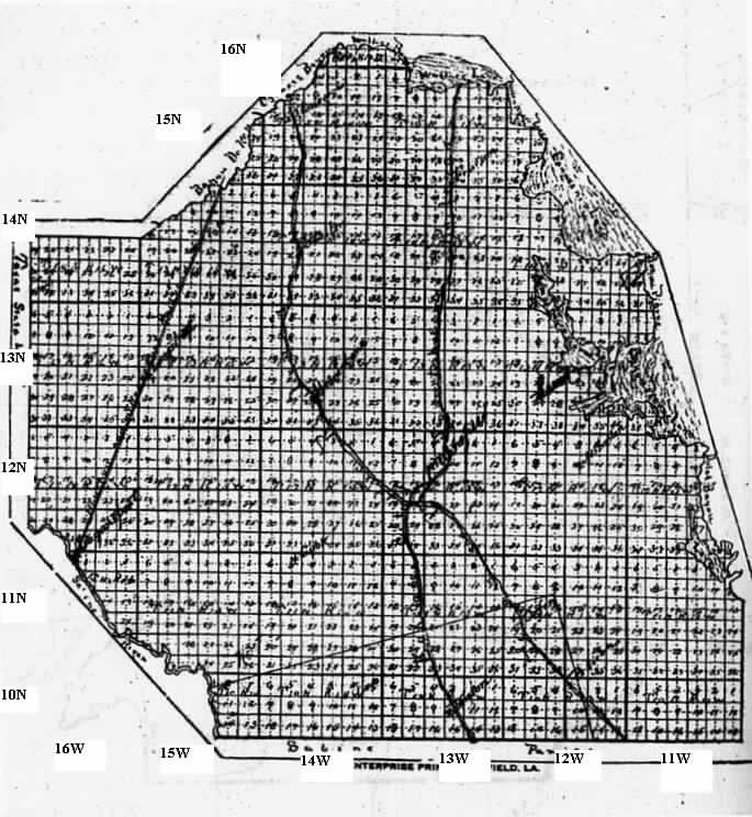
All or part of Townships 10-16
North in Ranges 10-16 West of the Louisiana Meridian lie in DeSoto Parish.
The map below shows the parish divided into sections. The bolder
(somewhat) lines are range/township dividers. On the left are township
numbers, placed roughly at the midline of each township. Beneath are
range numbers, similarly placed. As this is a scan of a reduction
of a much larger map, the section numbers are almost impossible to read. Refer
to the paragraph above when trying to locate a specific section.
NOTE: The map does NOT show the little 'finger' of land on the eastern
parish line, bordered north & east by Bayou Pierre and lying in
Township 11N that extends into Range 10W.