

Texas
Welcome!
County Coordinator is Jane Keppler.
If you have any questions or would like to submit information for Robertson County, please email
one of the above.
We do not live in Robertson County so we cannot do research.
|
||
| site search by freefind |
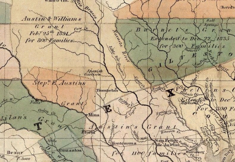
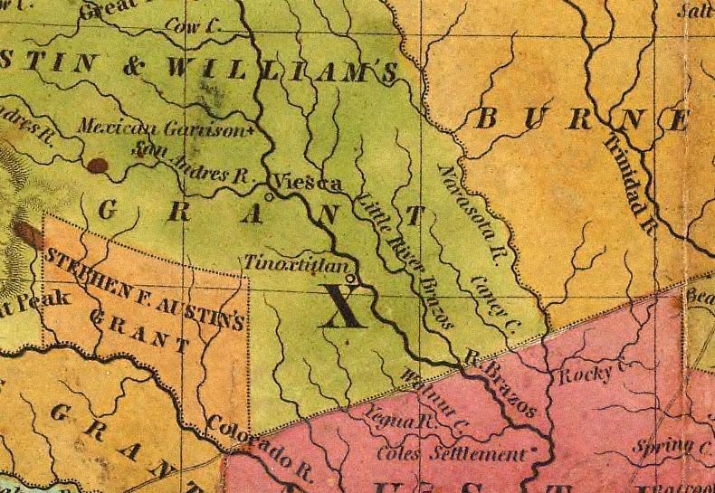
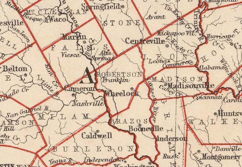
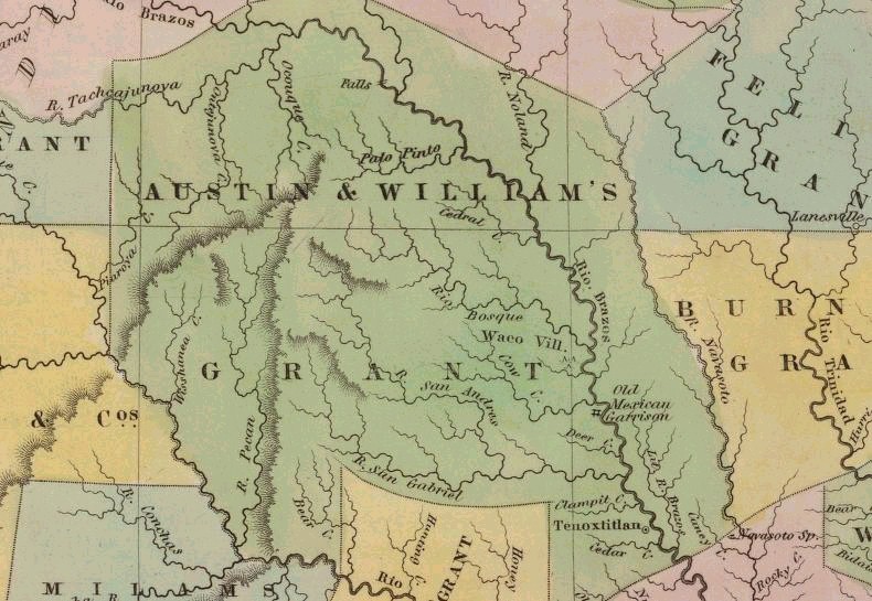
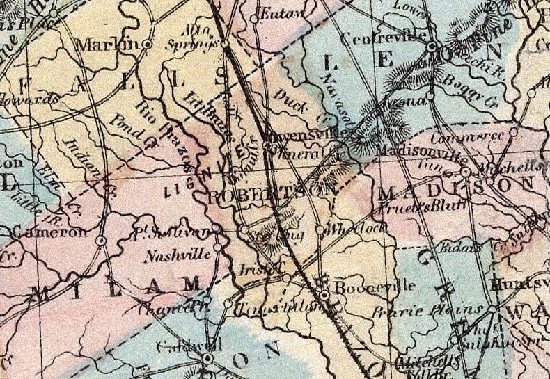
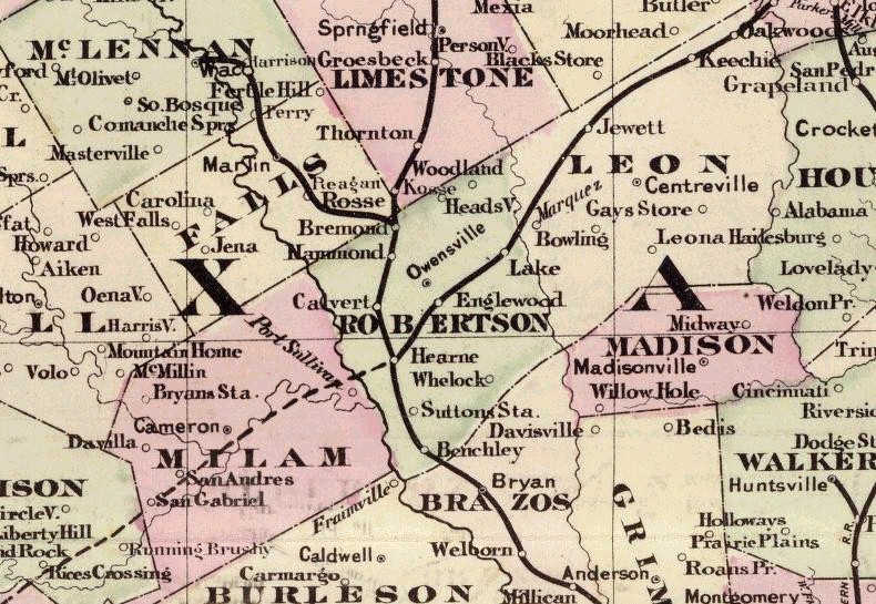
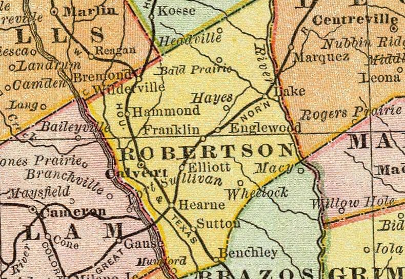
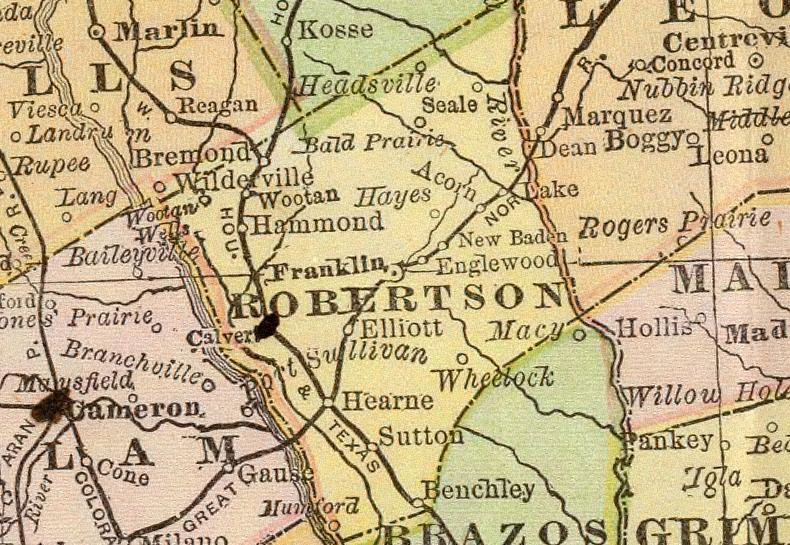
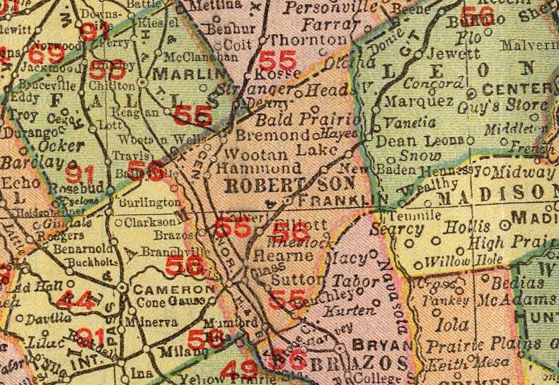
Interactive Maps
To navigate one of these maps, click on it. It will enlarge. Then, click on the area of the map you wish to see. Another map of the selected area will appear. You can enlarge the map by using the drop-down menu under "Resolution" to go to 6%, 12%, 25%, 50%, or 100% zoom.
Once enlarged, you should notice small black crosses enclosed in black rectangular boxes. These identify cemeteries. As the 50%-zoom map below illustrates, the New Baden & Mount Pleasant Cemeteries are clearly marked. The Brown #2 Cemetery is the unmarked cross on the road towards the New Baden Cemetery.
General Maps
| Map Names | Descriptions |
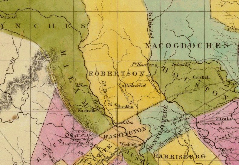
| Robertson's Original Colony & Present Day Counties | Central Texas Area Museum Of History, Salado, Bell County, TX, 1969 |
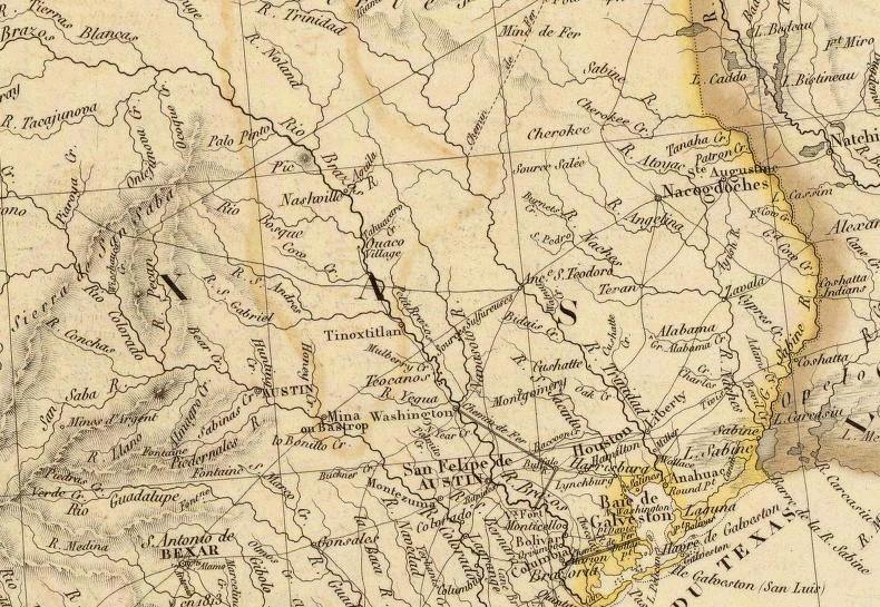
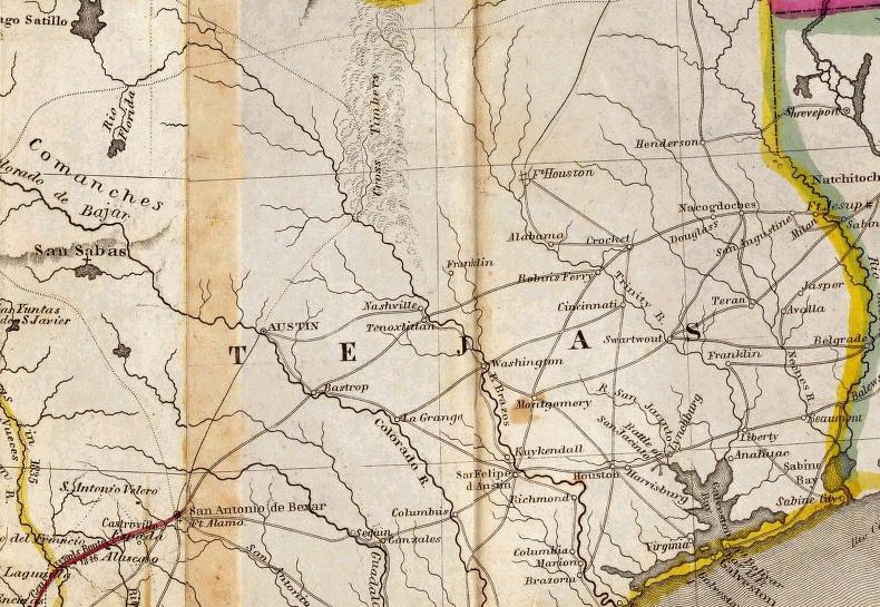
| 1835, Texas | by David H. Burr, Published By J. H. Colton & Co., New York, New York |
| 1836, New Map Of Texas | with the contiguous American & Mexican states, by J. H. Young, published by S. Augustus Mitchell, Philadelphia, Pennsylvania |
| 1836, State Of Texas | by Professor H. D. Rogers & A. Keith Johnston |
| 1838, Texas | by Thomas G. Bradford |
| 1840, Nouvelle Carte du Mexique du Texas | et d'une partie des stats limitrophes, by A. H. Brue, Paris, France |
| 1840, Texas | by Jeremy Greenleaf, compiled from the latest and best authorities |
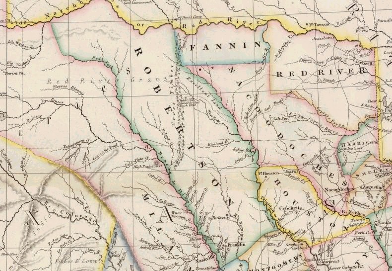
| 1844, Map Of Texas | compiled from surveys recorded in the land office of Texas and other official surveys, by John Arrowsmith, Soho Square, London, England |
| 1844, Map Of Texas & The Countries Adjacent | compiled by the Bureau of the Corps of Topographical Engineers from the best authorities for the State Department, by E. H. Emory, War Department |
| 1846, Map Of Texas | from the most recent authorities, published by C. S. Williams, Philadelphia, PA |
| 1847, Mapa de los Estados Unidos de Mejico | I. Distuenell, 102 Broadway, Nueva York |
| 1856, Texas | published by J. H. Colton & Co, No. 172, William Street, New York, New York |
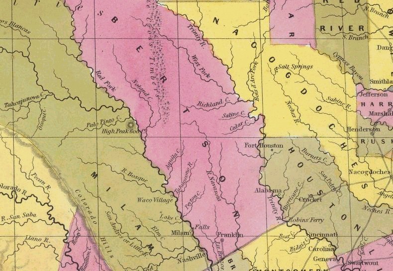
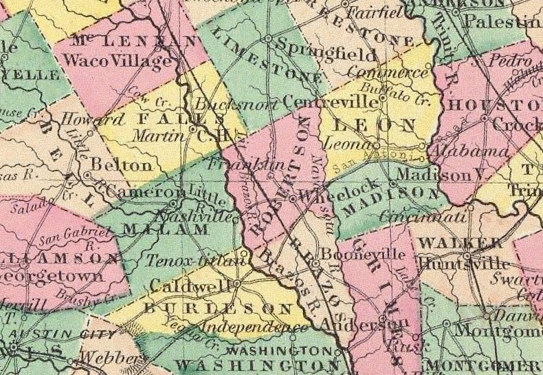
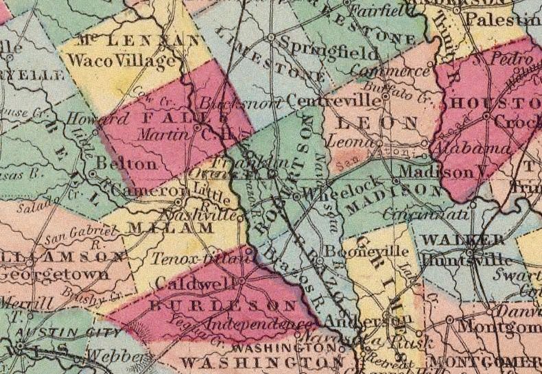
| 1856, J. De Cordova's State Of Texas | compiled from the records of the general land office of the state by Robert Greuzbaum, revised & corrected by Charles W. Pressler, J. H. Colton & Co., No. 172, William Street, New York, New York |
| 1857, Texas of the United States | showing the Galveston, Houston, & Henderson Railroad |
| 1860, Johnson's Texas | by J. J. Johnson & Browning |
| 1861, Richardson's New Map Of The State Of Texas | including part of Mexico, compiled from government surveys & other authentic documents, published by Charles De Silver, No. 714 Chestnut Street, Philadelphia, Pennsylvania |
| 1875, Cram's Railroad & Township Map Of Texas | published by George F. Cram, proprietor of Western Map Depot, 66 Lake Street, Chicago, Illinois |
| 1882, Map Of Texas | new enlarged scale, showing every railroad station & post office in the state, Rand McNally & Co., Chicago, Illinois |
| 1882, Original New Baden Landowners Plat | large fold-out map included in 1882 Deutsch Colony Of New Baden booklet by John George Meyer, New Baden, TX, The Center For American History Collection, The University of Texas at Austin |
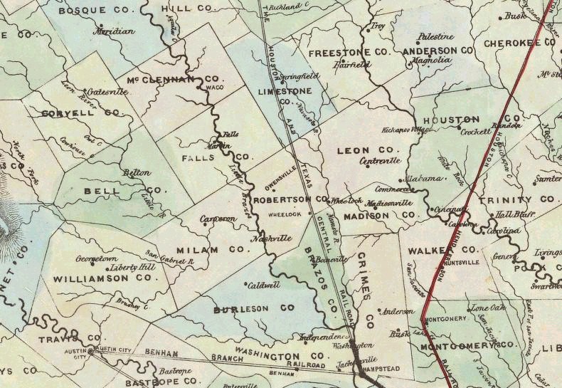
| 1891, County & Railroad Map Of Texas | large scale, compiled from the latest and most accurate surveys, Rand McNally & Co., map publishers and engravers, Chicago, Illinois |
| 1902, Texas | by Rand McNally & Co., Chicago, Illinois |
| 2001, Robertson County Map | Robertson County Appraisal District, 108 Morgan Street, Post Office Box 998, Franklin, Texas 77856, 979.828.5800 |
| 2001, Robertson County Map | Hearne
Chamber Of Commerce, 304
South Market Street, Hearne, Texas 77859 979.279.2351 phone |
| Calvert |
1885: https://www.loc.gov/item/sanborn08451_001/ 1891: https://www.loc.gov/item/sanborn08451_002/ 1896: https://www.loc.gov/item/sanborn08451_003/ 1901: https://www.loc.gov/item/sanborn08451_004/ 1906: https://www.loc.gov/item/sanborn08451_005/ 1911: https://www.loc.gov/item/sanborn08451_006/ These links provided by Brends Van De Walle: underthechandelier.calvert@gmail.com |

*
*
Page Modified:
23 October 2025


Copyright @ 2014-present by
Jane Keppler.
This
information may be used by individuals for their own personal use,
libraries and genealogical societies. Commercial use of this information
is strictly prohibited without prior written permission from
Jane Keppler.
If material is copied, this copyright notice must appear with the
information and please email me and let me know. Neither the Site Coordinators nor
the volunteers assume any responsibility for the information or material
given by the contributors or for errors of fact or judgment in material
that is published at this website.
Page Modified: 23 October 2025
Copyright @ 2014-present by